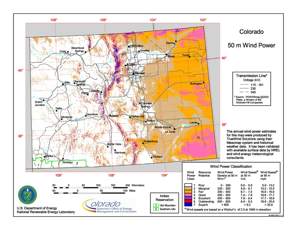
Colorado 50-Meter Community-Scale Wind Resource Map
Source: National Renewable Energy Laboratory and AWS Truepower. See data details.
This resource map shows estimates of wind power density at 50 m above the ground and depicts the resource that could be used for community-scale wind development using wind turbines at 50-60-m hub heights.
As a renewable resource, wind was classified according to wind power classes, which were based on wind speed frequency distributions and air density. These classes ranged from Class 1 (the lowest) to Class 7 (the highest). In general, at a 50-m height, wind power Class 4 or higher could have been useful for generating wind power with turbines in the 250-kW to 750-kW rating. Given the advances in technology, resources below Class 4 may now be suitable for the new midsize wind turbines. In recognition of these continuing advancements in wind energy technologies and the ability for the current generation of wind turbines to extract cost competitive wind energy from lower wind speeds the Energy Department has moved away from the wind power classification system and now reports wind speeds only.
This map indicates that Colorado has wind resources consistent with community-scale production. Significant contiguous areas of good resource with embedded regions of excellent resource are found in the eastern quarter of the state. The excellent resource areas within the eastern quarter of Colorado are concentrated near the New Mexico and Nebraska borders. An area of excellent-to-outstanding resource is located along the Wyoming border north of Fort Collins. The exposed ridge crests of the Front Range, the Continental Divide, and in western Colorado also have good-to-outstanding wind resource.