Illinois 30-Meter Residential-Scale Wind Resource Map
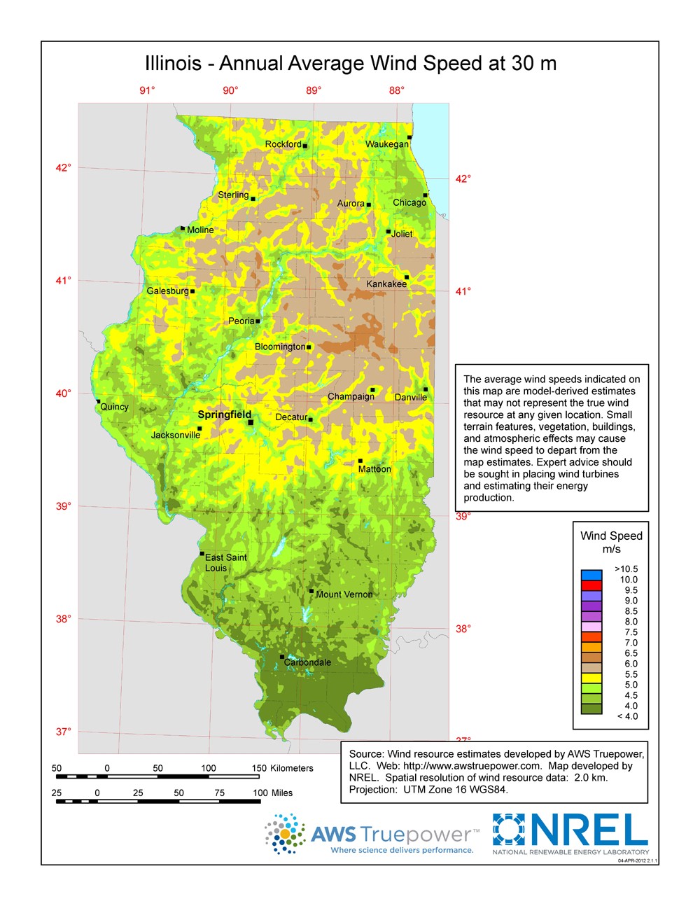
This map shows the predicted mean annual wind speeds at a 30-m height, presented at a spatial resolution of 2 kilometers that is interpolated to a finer scale. Areas with good exposure to prevailing winds and annual average wind speeds around 4 meters per second and greater at a 30-m height are generally considered to have a suitable wind resource for small wind projects. Small wind turbines are typically installed between 15 and 40 m high.
Given the technological advancements in the wind industry, locations with lower wind speeds that may not have been suitable for wind development in the past may be suitable today or in the future.
The average wind speeds indicated on this map are model-derived estimates that may not represent the true wind resource at any given location. Small terrain features, vegetation, buildings, and atmospheric effects may cause the wind speed to depart from the map estimates. Consumers should seek expert advice for siting wind turbines and estimating their energy production.