Alaska 50-Meter Community-Scale Wind Resource Map
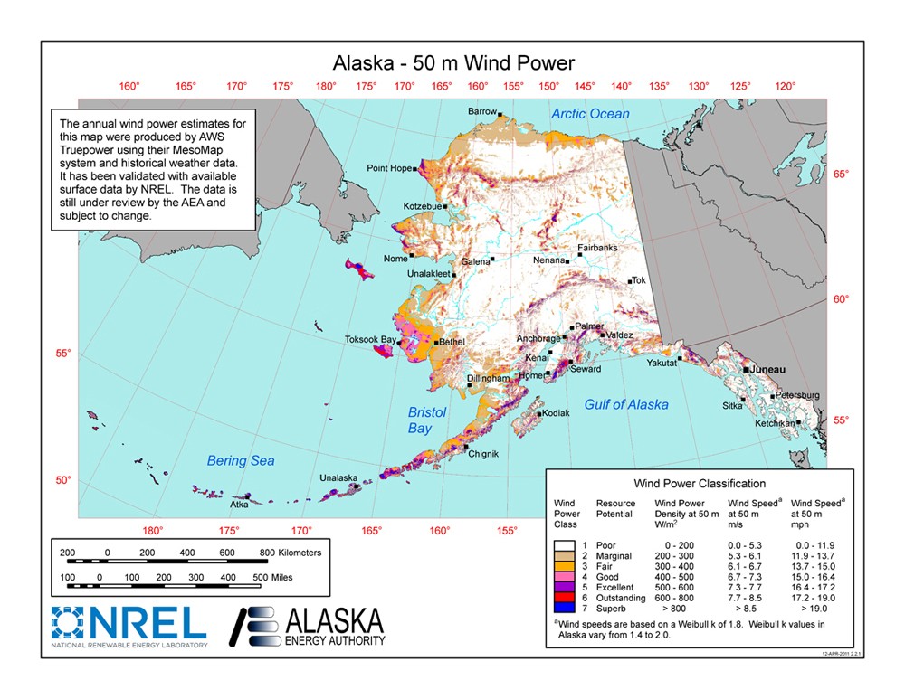
Source: National Renewable Energy Laboratory and AWS Truepower
This resource map shows estimates of wind power density at 50 m above the ground and depicts the resource that could be used for community-scale wind development using wind turbines at 50-60-m hub heights.
As a renewable resource, wind was classified according to wind power classes, which were based on wind speed frequency distributions and air density. These classes ranged from Class 1 (the lowest) to Class 7 (the highest). In general, at a 50-m height, wind power Class 4 or higher could have been useful for generating wind power with turbines in the 250-kW to 750-kW rating. Given the advances in technology, resources below Class 4 may now be suitable for the new midsize wind turbines. In recognition of these continuing advancements in wind energy technologies and the ability for the current generation of wind turbines to extract cost competitive wind energy from lower wind speeds the Energy Department has moved away from the wind power classification system and now reports wind speeds only.
The map, showing mainland Alaska, indicates that mainland Alaska has wind resources consistent with community-scale production. The largest contiguous low elevation area of good-to-excellent resource is located in the western part of the state between Bethel and the Yukon River Delta. Coastal locations along the Bering Sea and the Arctic Ocean are likely to have good-to-excellent resource. Excellent wind resources are located on higher ridge crests crest locations throughout mainland Alaska including the Brooks and Alaska Ranges and the Chugach Mountains.
The data is still under review by the Alaska Energy Authority and subject to change.