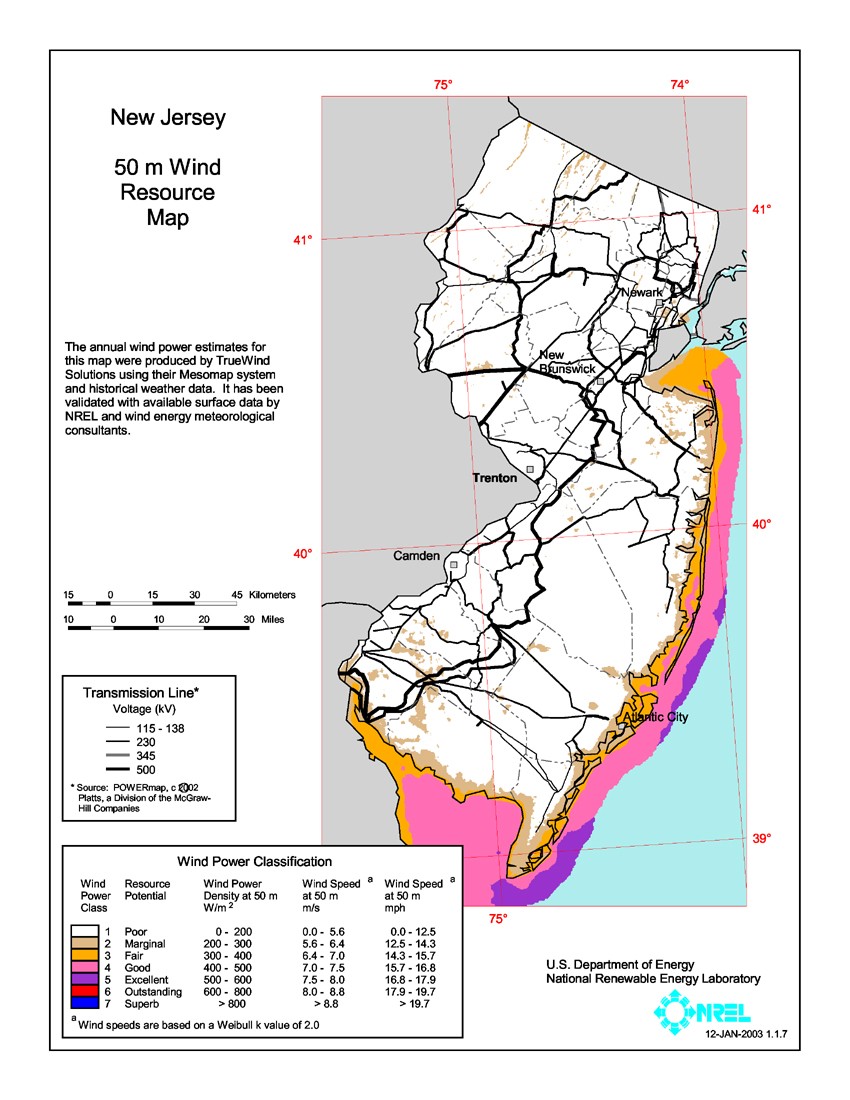
New Jersey 50-Meter Community-Scale Wind Resource Map
Source: National Renewable Energy Laboratory and AWS Truepower. See data details.
This resource map shows estimates of wind power density at 50 m above the ground and depicts the resource that could be used for community-scale wind development using wind turbines at 50-60-m hub heights.
As a renewable resource, wind was classified according to wind power classes, which were based on wind speed frequency distributions and air density. These classes ranged from Class 1 (the lowest) to Class 7 (the highest). In general, at a 50-m height, wind power Class 4 or higher could have been useful for generating wind power with turbines in the 250-kW to 750-kW rating. Given the advances in technology, resources below Class 4 may now be suitable for the new midsize wind turbines. In recognition of these continuing advancements in wind energy technologies and the ability for the current generation of wind turbines to extract cost competitive wind energy from lower wind speeds the Energy Department has moved away from the wind power classification system and now reports wind speeds only.
The highest resource areas are found along the Atlantic Ocean and Delaware Bay coastal areas, and on the ridges of western and northwestern New Jersey.